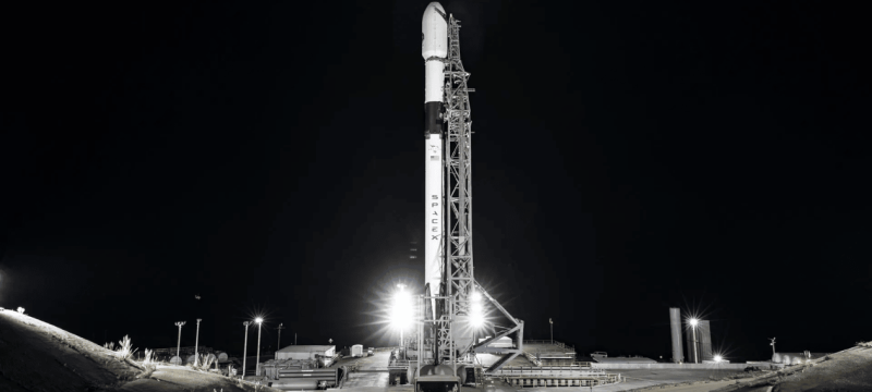
NASA, in collaboration with SpaceX and several international partners, has launched the Sentinel-6B satellite to enhance global ocean and atmospheric monitoring. The mission aims to improve hurricane forecasts, protect coastal infrastructure, and support commercial sectors, including shipping.
The satellite, roughly the size of a full-size pickup truck, lifted off on a SpaceX Falcon 9 rocket from Vandenberg Space Force Base in California. The launch took place at 9:21 p.m. PST on November 16. Contact with the spacecraft was established at 10:54 p.m. when it passed over a station in Northern Canada. NASA confirmed that all systems were operating normally.
Nicky Fox, associate administrator for NASA’s Science Mission Directorate, said understanding sea level changes is vital for daily ocean-related activities. She noted that the Sentinel-6B satellite will extend the work of its predecessor, Sentinel-6 Michael Freilich, by providing accurate global sea level measurements. These readings support communities, businesses, and operations across the United States. The data will also help ensure safer reentries for astronauts, including those returning from Artemis missions.
From its low Earth orbit position, the satellite will record sea levels with high precision, despite natural differences seen across different regions. Sentinel-6B will eventually replace the Sentinel-6 Michael Freilich satellite, which has served as the official reference for global sea level monitoring since 2020.
The mission is a joint effort involving NASA, the European Space Agency (ESA), EUMETSAT, and NOAA, under the EU’s Copernicus program. ESA’s Simonetta Cheli highlighted the importance of international cooperation, stating that the satellite will provide key data on wind speeds, wave heights, temperature, and humidity. These insights will help scientists study ocean behavior and improve marine weather predictions.
The Copernicus Sentinel-6/Jason-CS mission includes two satellites that continue decades of ocean-tracking work dating back to the early 1990s. The new satellite will analyze sea surface height changes, allowing researchers to identify warmer waters and monitor conditions that can lead to hurricanes. Sea level patterns also reveal interactions between ocean currents, such as the Gulf Stream, which can create rough seas and impact maritime operations.
NASA’s Earth Science Division Director, Karen St. Germain, said the observations collected by Sentinel-6B will guide critical decisions for coastal communities, defense agencies, emergency responders, and commercial industries.
Once it reaches its final orbit, the satellite will fly 30 seconds behind Sentinel-6 Michael Freilich to allow cross-calibration of data. After this process, Sentinel-6B will become the primary reference satellite, orbiting Earth 13 times a day at an altitude of 830 miles.
Dave Gallagher, director of NASA’s Jet Propulsion Laboratory, emphasized that the Sentinel-6B satellite can measure 90% of Earth’s oceans with extreme accuracy. He said the mission adds valuable data to a long-term record that supports global climate research.
In other news read more about: NASA-ISRO NISAR Satellite Successfully Launched to Monitor Earth’s Changes


